Top 10 U.S. States With the Ugliest Shape
Michigan is the only state where you can use you hands to point where u live and is the most recognizable on the map.
What is this? a glove? I guess that fits well because your cold but why a glove uncool man
 Maryland is a state located in the Mid-Atlantic region of the United States, bordering Virginia, West Virginia, Pennsylvania, Delaware, and Washington, D.C.
 It looks odd, but their congressional districts are even more disgusting.
Looks like an old fashioned weight scale or something
 Iowa is a U.S. state in the Midwestern United States, bordered by the Mississippi River on the east and the Missouri River and the Big Sioux River on the west.
Iowa is a strong Republican state with Constitutional Carry. Masks have never been mandatory and Iowa was never locked down.
Iowa is a U.S. state in the Midwestern United States, bordered by the Mississippi River on the east and the Missouri River and the Big Sioux River on the west.
Iowa is a strong Republican state with Constitutional Carry. Masks have never been mandatory and Iowa was never locked down. Nebraska is a state that lies in both the Great Plains and the Midwestern United States. Its state capital is Lincoln.
 New York is a state located in the Mid-Atlantic Region. New York was one of the original thirteen colonies that formed the United States. With an estimated 19.54 million residents in 2018, it is the fourth most populous state. In order to distinguish the state from the city with the same name, it is ...read more.
 Missouri is a state located in the Midwestern United States. It is the 21st most extensive, and the 18th most populous of the fifty states.
 Illinois is a state in the midwestern region of the United States. It is the 5th most populous state and 25th largest state in terms of land area, and is often noted as a microcosm of the entire country.
 Texas is a state in the Southern USA. It is the second largest by area and population. Its largest city is Houston.
 Really? This state, really? I'm sorry for you Texans, but your state shape is UGLY. It looks like a toilet at the top! I hate that shape, And, is it supposed to look like a star? I'm afraid not.
Reading these lists makes me think about what I'm doing with my life.
What a weird criteria for a state
 Ohio is a state in the midwestern region of the United States. Ohio is the 34th largest by area, the 7th most populous, and the 10th most densely populated of the 50 United States.
 I can't stand this shape! It looks like a terrible drawing of a bird wing! This could have been #1, but Texas, I just can't stand! Ohio, you have a shape to get rid of.
This should be number 52 (Including DC and Puerto Rico)
 California is a state in the Southwestern United States. With 39.6 million residents across a total area of about 163,696 square miles (423,970 square kilometers), California is the most populous U.S. state and the third-largest by area. The state capital is Sacramento, and the largest city is Los Angeles. ...read more.
 West Virginia is a state located in the Appalachian region of the Southern United States. It is bordered by Pennsylvania to the north, Maryland to the east and northeast, Virginia to the southeast, Kentucky to the southwest, and Ohio to the northwest. West Virginia is the 41st largest state by area, ...read more.
Whoops! I dropped that pot on the floor! Seriously, it looks like a burnt pot from tornadoes! I hate it, hate it, HATE IT! Oklahoma, STOP MAKING YOUR STATE LOOK LIKE AN IDIOTIC OBJECT!
 Wyoming is a state in the mountain region of the Western United States. The state is the tenth largest by area, but the least populous and the second least densely populated of the 50 United States.
 It's just a rectangle. Really? A rectangle? WHY IS IT A RECTANGLE!? Wyoming, get a new shape design!
This is as plain as it gets.
 Rhode Island, officially the State of Rhode Island and Providence Plantations, is a state in the New England region of the United States.
 Utah is a state in the western United States. It became the 45th state admitted to the Union on January 4, 1896. Utah is the 13th-largest, the 31st-most populous, and the 10th-least-densely populated of the 50 United States.
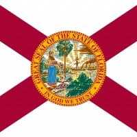 Florida is a state located in the southeastern region of the United States. Florida is the southeasternmost U.S. state, with the Atlantic on one side and the Gulf of Mexico on the other.
 Is it an appendix or a dick!? Who cares, it's ugly!
It was so ugly that it made the list twice!
 Mississippi is a southern U.S. state with the Mississippi River to its west, the state of Alabama to its east, and the Gulf of Mexico to the south.
 Delaware is one of the Mid-Atlantic states located in the Northeast megalopolis region of the United States.
 Colorado is a state in the United States encompassing most of the Southern Rocky Mountains as well as the northeastern portion of the Colorado Plateau and the western edge of the Great Plains.
 Same rectangle like Wyoming, enough said.
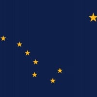 Alaska is a U.S. state situated in the northwest extremity of the Americas. The Canadian administrative divisions of British Columbia and Yukon border the state to the east; it has a maritime border with Russia to the west across the Bering Strait.
 Minnesota is a state in the Midwestern United States. Minnesota was admitted as the 32nd state on May 11, 1858, created from the eastern half of the Minnesota Territory.
 South Carolina is a state in the southeastern region of the United States. The state is bordered to the north by North Carolina, to the south and west by Georgia across the Savannah River, and to the east by the Atlantic Ocean.