Top 10 Most Unusual International Borders
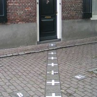
This is one of the funniest unusual borders - thank god it's a symbolic border and is rather a source of jokes than conflicts. A section of the border goes through the town of Baarle, separating it into 2 parts: Belgian (named Baarle-Hertog) and Dutch (named Baarle-Nassau). The border goes through houses, supermarkets and restaurants.
So your kitchen can be in The Netherlands and your bedroom in Belgium, and you actually cross the border a million times in your own home.
There's a bonus: according to Dutch laws, restaurants have to close earlier, but this isn't a problem - you just have to take your chair and table and finish your drink on the Belgian side, which is a foot away.
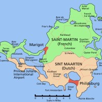
France and the Netherlands don't meet in Europe, but they do in the Caribbean! They have a border on the island of St. Martin/Sint Maarten where the northern half - St. Martin - is French, while the southern half - Sint Maarten - is Dutch.
There is a hotel with a very interesting location, right on the border (Captain Oliver's Hotel) where you can sleep on the Dutch side and eat in the restaurant on the French side. Sounds great - French cuisine is the best in the world.
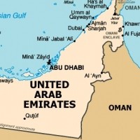
This border is not defined. It lies in an unfriendly desert, so the vagueness is not an urgent issue.
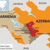
There are four exclaves or islands of territory that lie in the opposite country! The largest exclave is Azerbaijan's Naxcivan exclave, a significant piece of territory located within Armenia.
Naxcivan aka Nakhchivan is an autonomous Republic, part of the Republic of Azerbaijan.
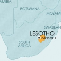
The Kingdom of Lesotho is entirely surrounded by South Africa. Lesotho is an enclave, meaning that to access its territory you have to cross the territory of South Africa.
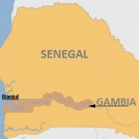
Gambia lies entirely within Senegal. And looks like a large intestine/colon...
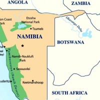
Namibia's Caprivi Strip is a panhandle that extends several hundred miles, separating Botswana from Zambia.
Shortest border in the world between Botswana and Zambia (less than a hundred meters).
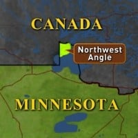
It's an inlet of the Lake of the Woods, that is part of Minnesota, US, but lies in Manitoba, Canada. There is no direct driving route from the US to this area so you can come either from Canada or by crossing the Lake of the Woods.
The Angle became part of the US due to an oversight: during the 1783 Treaty of Paris, the border drawn between the US and what was then British territory was designed to cut through the Lake of the Woods area at a northwest angle, but the map they used misrepresented the lake's location.
This geographic oddity hasn't been an issue because USA - Canada border is peaceful.
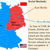
West Berlin was entirely in East Germany (in the image West Berlin is the small blue spot in the middle of East Germany).
The boundary, defined in the 1970s, has not been publicly announced so cartographers are guessing (meaning, just draw 2 straight lines, as you can see in the image). But it hasn't been an issue - again, because it's in a desert.
Update: Ha! Where's the image I added? It got approved, was on the list for several months and then disappeared.
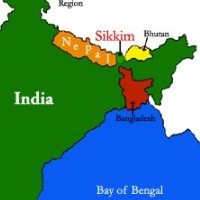
Visually on the map, Nepal and Bangladesh "squeeze" India so much that far eastern India looks almost like an exclave. Indian territory between Bangladesh and Nepal is really narrow - less than twenty miles (30 kilometers).
Also, there are 92 separate bits of Bangladesh inside Indian territory, and 106 bits of India inside Bangladeshi territory.
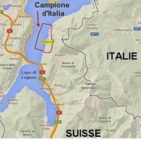
Campione d'Italia is an Italian municipality located in Switzerland - the story started in 1798.
Because of an railroad that also belongs to Belgium there are 5 columns of land wich are separated from Germany but belong to Germany.
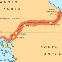
Korean Demilitarized Zone is a buffer between North Korea and South Korea created in 1953. It's a 2.5 mile-wide and 155-mile-long stretch that turned into a green belt with rare wildlife. Both countries have cooperated to protect the wildlife such as endangered cranes, Siberian tigers, roe deer, gorals, and wild boar.
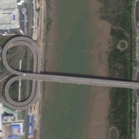
This border is like a celebration of the traffic rules, LOL.
The border is on a bridge - the Lotus Bridge. A bridge that connects countries that drive on opposite sides of the road!
In China, you drive on the right, and in Macau you drive on the left, like in the UK. So on the Lotus Bridge you can test your driving skills. Sounds like fun.
What? I thought France borders Monaco not China...
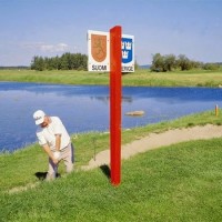
The border goes right through the golf club and golf course, where 11 holes are in Sweden and 7 are in Finland.
The best thing is that thanks to the time difference, you can hit the longest Hole-in-one in the world on the 6th hole because the borderline lies on the 6th green and the ball flies approximately one hour and 5 seconds! Actually, it's only 5 seconds.
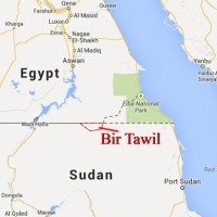
This is funny because it seems nobody wants this land (Bir Tawil) and its status is "terra nullius" ("nobody's land").
Bir Tawil or Bi'r Tawil is an area along the border between Egypt and Sudan that was officially wedged between them but neither country claimed it. Strange, because the area is habitable, but uninhabited.
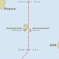
The border goes between the Diomede Islands - two small rocky islands located in Bering Strait between Alaska and Siberia.
Little Diomede is smaller, belongs to the US and is inhabited. Big Diomede is bigger, belongs to Russia and is uninhabited.
At their closest points, the two islands are about 3.8 km (2.4 mi) apart, but Big Diomede is almost a day ahead of Little Diomede (21 hours!) because the International Date Line also separates them, besides the border. So Little Diomede is called Yesterday Isle, and Big Diomede - Tomorrow Island.
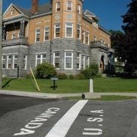
Derby Line is a village in Vermont, US, that is essentially one town with Stanstead, a town in Quebec, Canada. This is one town separated by the border long ago (it's the North American version of Baarle in Europe).
The border passes through many buildings and homes, including a factory. The Canadian part of the factory closed in 1982 but the factory in Derby Line is open.
The Haskell Free Library and Opera House, opened in 1904, were intentionally built on this border in such a manner that stage and half of the seats are in Canada while the entrance and the remainder of the opera hall is in the US.
A thick black line runs beneath the seats of the opera house and diagonally across the center of the library's reading room to mark the Canada-US border.
Visitors don't need to show a passport to enter, but cannot use the library and opera house to cross between the countries - they can only enter, either use the library or see a show at the opera house, then return to their starting country.
The library has two different addresses: 93 Caswell Avenue, Derby Line, Vermont, and 1 rue Church (Church Street), Stanstead, Quebec. And different phone area codes, but phone calls between Derby Line, Vermont and Rock Island, Québec is local.
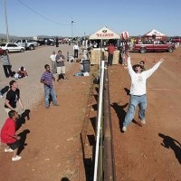
A border town (Naco) is split into two. The border is sometimes used to play volleyball over it.
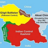
The borders in the Kashmir region are quite complicated - Indian Control Kashmir, Pakistani Control Kashmir, Chinese Control Kashmir, Azad Kashmir...
This border is quite complicated, I was kinda planning to make this list though