Top Ten Most Dangerous Cloud Types
This list is about risk and hazard in cloud types. If you care to do any research, be my guest! These clouds were rated a 1 to 5 on my excel. 1 means no harm at all. 2 means that the cloud can possibly lead to rain but do it indirectly rather than itself. 3 means that there is some sort of precipitation (not a drizzle or virga). 4 means that there's very strong precipitation going on. 5 means a storm is upon us.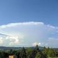
That will surely ruin your day
Almost nearly as fierce as #1, it has many things like the Capitallus. These include lightning, hail and winds that can lead to downbursts. Though it mainly lacks heavy rain which is a big aspect as it could cause flash floods, so it stands at silver.
Altostratus scored a 4 rather than a 5 due to its non-storm behavior. But it still did have some aspects. For example, quite heavy precipitation that can lead to flash flooding if gone long enough. Surprisingly, it's the only 4 in the entire scale.
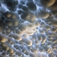
These clouds usually don't cause precipitation in the first place and when they do, it's often light rain or snow. The reason why this is above the other 3's is because that even though these cause almost no rain, they are indicators of later thunderstorms so that boosts it ranks a little to be #5.
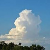
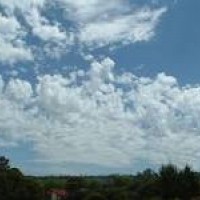
These clouds are just about the same rank as #5. The only reason why it's behind #5 is because it causes light precipitation but usually doesn't lead to later storms. Also, yay! Finally a picture!
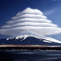
These clouds look very beautiful - remind me of Chinese style roofs
They look pretty sick!
To make a point here, this cloud type should have been number one. I don't know how I forgot it. It's much more capable of tornados, extreme winds, and heavy rain (which could lead to flash floods) than any other cloud. This means Capitallus just got knocked off the top spot!
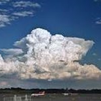
Should be at the top, while it's associated with anvil clouds and not really a cloud type of its own, it's definitely the most dangerous one causing heavy rain, heavy thunderstorms and occasionally tornadoes. They mostly appear in the US
A supercell, while a storm, isn't a type of cloud. It's mainly composed of either Capitallus or Incus clouds (but most likely incus for the stronger ones). Therefore, this shouldn't be a candidate. Still like the idea though.
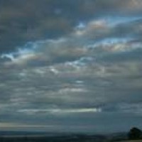
These clouds are on the bottom border of the 3's. This is because it doesn't produce precipitation but it does signify later thunderstorms so I have to give it a 3 as this is one of those few exceptions:).
These clouds score a 2.5 in my scale due to it causing precipitation but in the form of virga. Read scale description if you don't know what I mean.
Yeah, rank 5 seems about right for these kind of clouds.
They will appear before a storm, and after a storm
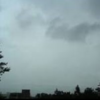
These clouds don't have any chance at producing precipitation but can signify stronger storms are on the way. This also scores a 2.0 in my scale.